
Earthquakes: The Release of Energy Stored Within the Earth and the Science of Seismic Hazard
Earthquakes release stored energy, shaking the ground through seismic waves.
Share this story
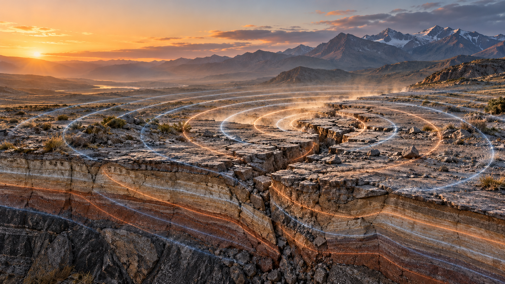
Let us explore how earthquakes occur, how they are connected to tectonic plates, faults, and seismic waves, how magnitude and intensity are measured, and why earthquake-resistant construction is essential for reducing seismic risk.
Introduction
An earthquake is the sudden release of mechanical energy accumulated within the Earth. It most commonly occurs when rock masses abruptly slip along a fault. The released energy travels through the crust and upper mantle as seismic waves, producing the ground shaking felt at the surface. [1]
An earthquake is not merely a natural disaster; it is also an important geological process. It provides evidence about Earth’s internal structure, active faults, interactions between tectonic plates, and deformation within rock masses. Seismology studies these processes to assess hazards, design safer structures, and develop early-warning systems.
Why Tectonic Plates Move
Earth’s rigid outer shell, the lithosphere, is divided into large and small tectonic plates. These plates consist of solid rock and move over the more slowly flowing asthenosphere. It is important to note that tectonic plates do not “float on liquid magma.” The mantle is composed predominantly of solid rock, although over geological timescales it can flow very slowly. [2]
Plate motion is driven by Earth’s internal heat and gravitational forces. Scientists consider several interconnected mechanisms especially important:
- thermal convection within the mantle;
- the outward movement of plates from mid-ocean ridges;
- the gravitational pull of cold, dense oceanic slabs descending into subduction zones, known as slab pull;
- the redistribution of stresses within the lithosphere.
These forces produce slow but continuous plate movement. Where motion is resisted by friction at plate boundaries or active faults within continents, stress begins to accumulate. [2][3]
Elastic Deformation: What Is Accumulated Stress?
Elastic deformation is the temporary change in shape or volume of a rock body caused by external forces. It can be partly or fully reversed if the stress is removed before the rock fractures or undergoes permanent structural change.
During plate motion, rock masses on opposite sides of a fault attempt to move, but irregular fault surfaces and friction temporarily prevent free slip. The rocks deform, storing elastic energy.
When the accumulated stress exceeds the frictional resistance of the fault, the rock blocks suddenly move. An earthquake occurs at that moment. This process is known as elastic rebound. [1]
Faults: Where Tectonic Earthquakes Originate
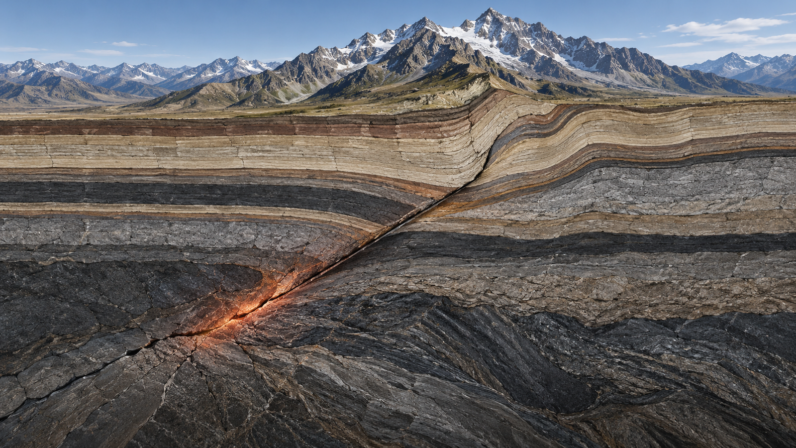
A fault is a fracture or fracture zone in rock through which rock masses on either side move relative to one another. Faults may range from a few metres to hundreds of kilometres in length. [4]
The principal types include:
- Normal faults — formed under extensional conditions, where the upper block moves relatively downward.
- Reverse or thrust faults — formed under compression, where one rock mass moves upward relative to another.
- Strike-slip faults — faults in which the main movement is horizontal.
- Oblique-slip faults — faults that combine both vertical and horizontal displacement.
Many of the world’s largest earthquakes occur on thrust faults in subduction zones. In these settings, one tectonic plate descends beneath another, allowing enormous stresses to accumulate along the plate interface.
Not Every Seismic Event Is Tectonic
Most earthquakes have a tectonic origin, but seismic instruments can also record events produced by other geological processes.
Collapse of Karst Cavities
In karst regions, groundwater can dissolve limestone, dolomite, gypsum, or salt-bearing rocks. Over time, this process can create underground cavities, cave systems, and weakened zones.
If the roof of a cavity loses stability, sudden collapse may occur. Such collapses can generate localized seismic signals or weak ground vibrations. They are generally not comparable to major tectonic earthquakes, but they are important in engineering geology because they may produce sinkholes, ground subsidence, and damage to structures. [5]
Induced Seismicity
In certain circumstances, human activity may contribute to the activation of faults that are already close to failure. Deep fluid injection, mining, geothermal projects, and large reservoirs can alter pressure conditions in the subsurface. [6]
This does not mean that human activity creates tectonic faults. Rather, it can affect the stability of an existing fault—for example, by increasing pore pressure and reducing frictional resistance.
Hypocenter, Epicenter, and Rupture Zone
The point within the Earth where an earthquake begins is called the hypocenter, or focus. Its vertical projection onto Earth’s surface is called the epicenter. [1]
However, a major earthquake is not a point-like event. Fault rupture may propagate across tens or hundreds of kilometres. For this reason, the strongest shaking or most severe damage does not always occur directly near the epicenter.
The spatial pattern of damage depends on:
- the length of the fault rupture and amount of displacement;
- hypocentral depth;
- the direction of rupture propagation;
- local geological conditions;
- the vulnerability of buildings and infrastructure.
Seismic Waves: How Energy Travels
The energy released during an earthquake travels as seismic waves. These are divided into body waves and surface waves.
P Waves
P waves, or primary waves, are compressional waves. They are the fastest seismic waves and can travel through solids, liquids, and gases.
S Waves
S waves, or secondary waves, are shear waves. Rock particles move perpendicular to the direction in which the wave travels. S waves can propagate only through solid materials.
Surface Waves
Love waves and Rayleigh waves travel near Earth’s surface and often have large amplitudes. They can produce strong horizontal, vertical, or rolling ground motion and are frequently responsible for much of the destructive shaking during major earthquakes. [7]
Seismic Waves as a Tool for Studying Earth’s Interior
Seismic waves are valuable not only for locating earthquakes. Their velocity, reflection, refraction, and attenuation change as they travel through materials with different densities, compositions, and physical properties.
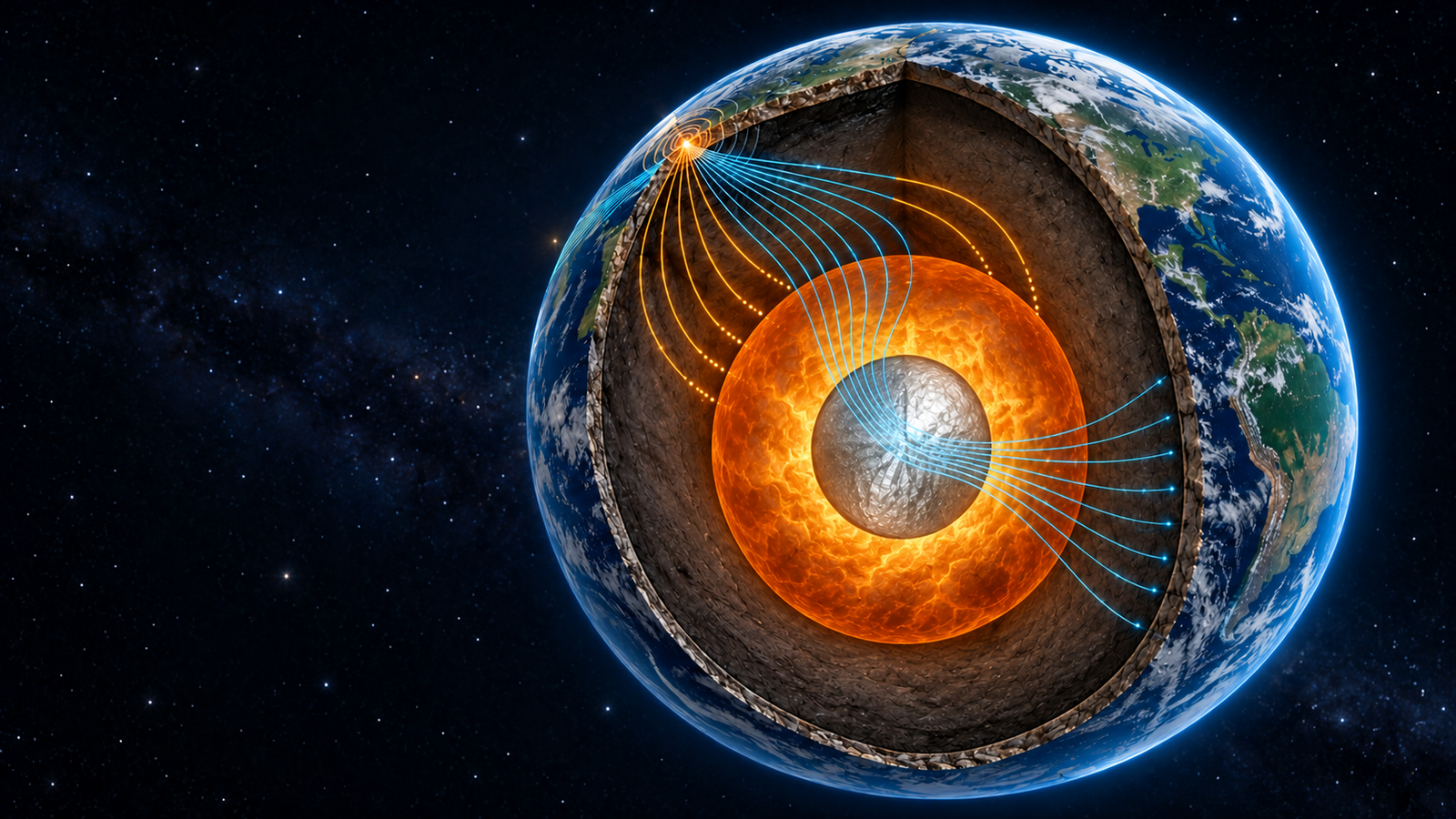
The study of waves produced by natural earthquakes has allowed scientists to reconstruct Earth’s major internal layers: the crust, mantle, liquid outer core, and solid inner core. For example, the absence of S waves in the outer core indicates that this layer is liquid. [8]
Seismic exploration applies the same physical principles in a practical setting. Geologists and geophysicists generate controlled seismic waves and record their reflections and refractions with geophones. These data help determine ground stratigraphy, bedrock depth, faults, sediment thickness, and engineering-geological conditions relevant to construction. [9]
The Richter Scale, Moment Magnitude, and Intensity Ratings
The Richter Scale
In 1935, Charles Richter developed the local magnitude scale, designated ML and later widely known as the Richter scale. It was based on the maximum amplitude of seismic waves recorded by a seismograph, adjusted for the distance from the epicenter. [10]
The Richter scale is logarithmic: an increase of one whole unit corresponds approximately to a tenfold increase in recorded wave amplitude. However, it was originally developed for local earthquakes in Southern California and for a particular type of instrument. It therefore has limitations when used for large or distant earthquakes.
Moment Magnitude
Today, large earthquakes are generally measured using moment magnitude, designated Mw. It is based not only on recorded wave amplitudes, but also on the area of the fault that slipped, the average amount of displacement, and the rigidity of the surrounding rock. [10][11]
An increase of one whole unit in Mw corresponds approximately to a 32-fold increase in released energy. Therefore, an Mw 7 earthquake is not merely “one degree stronger” than an Mw 6 earthquake; it is a substantially larger energy-release event.
Intensity Ratings
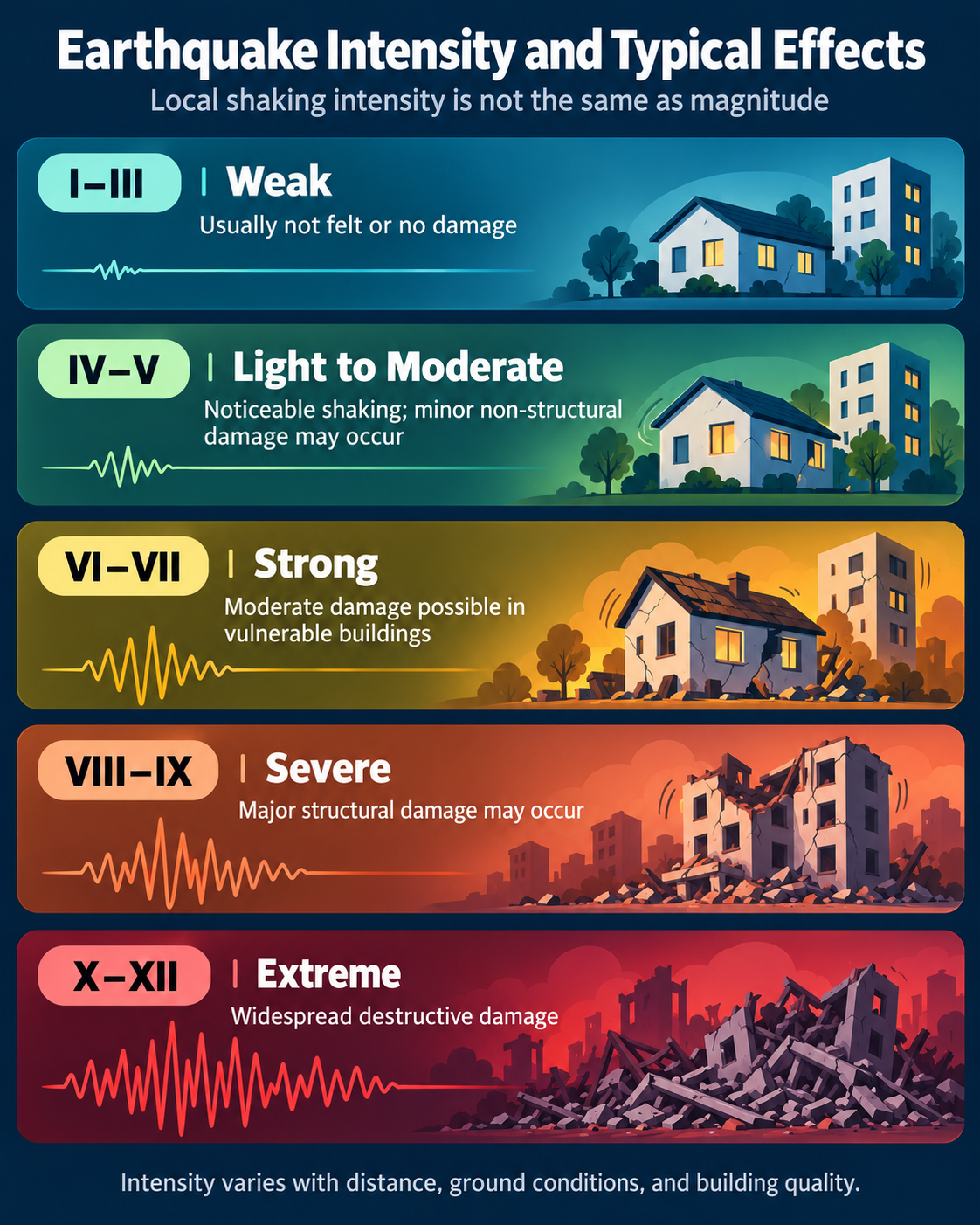
Magnitude describes the size of an earthquake at its source, while intensity describes its effects at a particular location. Intensity depends on distance, focal depth, local ground conditions, the properties of the seismic waves, and the vulnerability of the built environment.
The Modified Mercalli Intensity Scale, commonly used in the United States, describes observed effects using twelve levels from I to XII. [12]
In simplified form:
- I–II — not felt, or felt only by a few people;
- III–IV — noticeable indoors; windows, doors, or light objects may vibrate;
- V–VI — felt by most people; minor damage may occur in vulnerable structures;
- VII–VIII — noticeable to significant damage may occur in ordinary or poorly built structures;
- IX–XII — severe to catastrophic effects, especially in vulnerable or inadequately designed buildings.
The same earthquake can therefore produce different intensity levels in different locations.
Other Intensity Scales
European Macroseismic Scale 1998 — EMS‑98
In Europe, earthquake effects are commonly described using the European Macroseismic Scale 1998, or EMS‑98. Like the Modified Mercalli scale, EMS‑98 measures the severity of shaking at a specific location rather than the total energy released at the earthquake source. [13]
EMS‑98 also uses twelve degrees, from I to XII. It evaluates observed effects on people, objects, the natural environment, and buildings. Its defining strength is a systematic assessment of building damage according to structural type and vulnerability class. This makes it particularly useful for post-earthquake damage surveys, intensity mapping, and communication between seismologists and civil engineers.
The EMS‑98 scale is not a direct conversion from magnitude. A single earthquake has one reported magnitude, but it can produce many different EMS‑98 intensity values across the affected area.
MSK‑64 Scale
The Medvedev–Sponheuer–Kárník scale, or MSK‑64, is an earlier twelve-degree macroseismic intensity scale. It was widely used across Europe, the Soviet Union, and other regions during the twentieth century.
MSK‑64 evaluates human perception, structural damage, and environmental effects such as ground cracks, landslides, and rockfalls. Although EMS‑98 replaced MSK‑64 as the preferred European framework, MSK‑64 remains important when interpreting historical earthquake catalogues, archival reports, and older regional seismic records. [14]
Japan Meteorological Agency Seismic Intensity Scale
Japan uses the Japan Meteorological Agency Seismic Intensity Scale, commonly called the JMA scale. Unlike traditional macroseismic scales, JMA intensity is determined instrumentally using seismic intensity meters. [15]
The JMA system has ten categories:
The JMA scale has ten categories: 0, 1, 2, 3, 4, 5 Lower, 5 Upper, 6 Lower, 6 Upper, and 7—the highest level.
It is designed for rapid operational use. After an earthquake, JMA publishes observed local intensities to support emergency response, transport control, public warnings, and damage assessment. The JMA scale cannot be directly converted into EMS‑98, MMI, or Mw because each system measures or classifies shaking differently. [15]
Magnitude measures the size of an earthquake at its source. Intensity scales describe the effects of shaking at a particular location. PGA, PGV, and spectral acceleration are instrumental measurements of ground motion used in engineering and hazard assessment.
Instrumental Ground-Motion Parameters
Macroseismic scales describe observed effects, but engineers also rely on instrumental measurements recorded by accelerometers and seismometers. These measurements are essential for earthquake-resistant design, ShakeMap products, and structural assessment. [16]
Peak Ground Acceleration — PGA
Peak Ground Acceleration, or PGA, is the maximum acceleration of the ground during an earthquake. It is commonly expressed as a fraction or percentage of standard gravitational acceleration (g).
PGA is especially important for evaluating short-period shaking and the inertial forces acting on low-rise or stiff structures. However, PGA alone does not fully describe the likely damage potential of an earthquake because structural response also depends on duration, frequency content, and the dynamic properties of the building.
Peak Ground Velocity — PGV
Peak Ground Velocity, or PGV, is the maximum ground velocity recorded during shaking, commonly expressed in centimetres per second.
PGV is often useful for evaluating potentially damaging ground motion because it better represents the intensity of strong, longer-period shaking than PGA alone in many circumstances. It is routinely included in USGS ShakeMap products alongside PGA and estimated intensity. [16]
Spectral Acceleration
Spectral acceleration describes the response of an idealized single-degree-of-freedom oscillator, with a specified natural period and damping ratio, to recorded ground motion.
In practical terms, it indicates how strongly a structure with a particular natural vibration period is expected to respond during an earthquake. Engineers use spectral acceleration values at different periods to design buildings, bridges, and other structures according to their expected dynamic behaviour. [16]
For this reason, modern seismic design does not rely only on a single magnitude value or on PGA. It uses response spectra, local ground conditions, structural period, ductility, and building-code requirements to estimate realistic seismic demand.
Ground Conditions and Soil Liquefaction
The severity of seismic shaking often depends on the properties of near-surface ground materials. Weakly consolidated, water-saturated granular deposits can amplify seismic vibrations.
Soil Liquefaction
Soil liquefaction is a physical process in which water-saturated sandy, silty, or artificial fill materials temporarily lose their bearing capacity during strong earthquake shaking and behave more like a liquid. [17]
As shaking rearranges the grain structure, pore-water pressure may rise sharply. As a result, effective contact between grains decreases, and the ground can no longer adequately support structures.
Liquefaction may cause:
- settlement or tilting of buildings;
- damage to roads and utility networks;
- lateral spreading of ground;
- sand and water ejections at the surface.
Tsunamis: Why Vertical Displacement Is Usually More Dangerous
A tsunami occurs when a large volume of water is suddenly displaced. This displacement may result from an earthquake, submarine landslide, volcanic activity, or major collapse. [18]
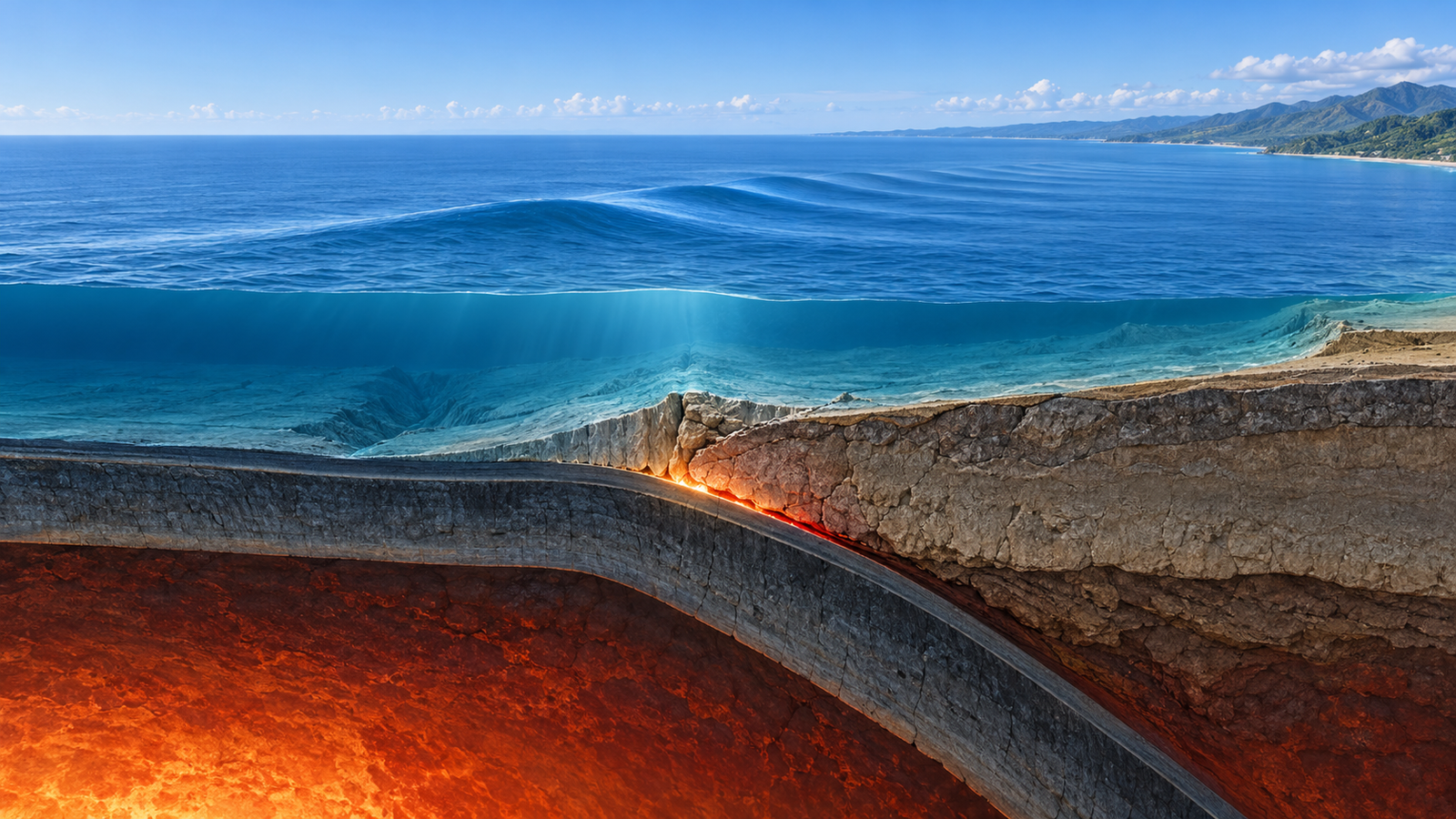
For tectonic earthquakes, the most effective tsunami-generating mechanism is usually vertical or oblique-vertical deformation of the seafloor. When a large area of the seabed rapidly rises or subsides, the water column above it is displaced as well, generating long-wavelength tsunami waves.
Strike-slip faults can also produce very powerful earthquakes, but purely horizontal movement usually causes little change in the height of the water column. For that reason, it is generally less effective at generating tsunamis.
Nevertheless, horizontal fault movement can contribute to tsunami generation if:
- the fault also has a vertical displacement component;
- the movement destabilizes a submarine slope and triggers a landslide;
- displacement occurs near steep underwater topography or an inclined wall;
- the earthquake initiates another large-scale collapse.
Therefore, not every strong underwater earthquake generates a tsunami. The key condition is the rapid and substantial displacement of a large body of water. [18][19]
Secondary Earthquake Hazards
In addition to ground shaking, earthquakes may trigger:
- surface fault rupture;
- soil liquefaction;
- landslides and rockfalls;
- tsunamis;
- fires and technological accidents;
- aftershocks;
- disruption of infrastructure and communications.
Aftershocks may continue for days, months, or longer. They are particularly dangerous where the main earthquake has already weakened or damaged buildings. [20]
Can Earthquakes Be Predicted?
Modern science cannot yet determine the exact time, location, and magnitude of a future major earthquake. Animal behaviour, weather conditions, gas emissions, or isolated small earthquakes have not become reliable and universal methods of prediction. [20]
However, scientists can:
- identify active faults;
- prepare seismic hazard maps;
- estimate long-term probabilities;
- assess likely aftershock sequences;
- operate earthquake early-warning systems.
Early warning is not prediction. It begins after an earthquake has already started, when nearby instruments detect fast-moving P waves. If a location is sufficiently far from the rupture zone, an alert may arrive seconds or tens of seconds before stronger S waves and surface waves reach it. [21]
Earthquake-Resistant Construction and Risk Reduction
Earthquakes cannot be prevented, but their consequences can be greatly reduced. Seismic risk can be expressed in simplified form as:
Seismic Risk ≈ Seismic Hazard × Exposure × Vulnerability
This means that two earthquakes of similar magnitude can have very different consequences depending on population density, ground conditions, construction quality, and emergency preparedness.
The principal measures for reducing risk include:
- seismic zoning and engineering-geological investigations;
- compliance with earthquake-resistant design standards;
- retrofitting vulnerable buildings;
- special protection for critical infrastructure;
- secure anchoring of non-structural elements;
- public education and preparedness;
- early-warning and rapid-response systems.
Conclusion
An earthquake is the sudden release of energy accumulated within the Earth, most often caused by the movement of rock masses along faults. It reflects the motion of tectonic plates, the mechanical properties of rock, and the dynamic processes operating within the planet.
Although science cannot yet predict exactly when the next major earthquake will occur, seismology makes it possible to identify hazardous regions, assess seismic risk, study Earth’s deep structure, and develop safer construction methods. The most reliable way to reduce earthquake losses is through the combined use of scientific data, responsible planning, and sound engineering.
Sources
[1] U.S. Geological Survey — What Is an Earthquake and What Causes It?
[2] U.S. Geological Survey — Are Tectonic Plates Floating on Magma?
[3] U.S. Geological Survey — What Drives Tectonic Plates?
[4] U.S. Geological Survey — Fault Types and Fault Motion
[5] Lenti et al. — Microseismicity Within a Karstified Rock Mass Due to Cracks and Collapses
[6] U.S. Geological Survey — Hydraulic Fracturing and Induced Earthquakes
[7] EarthScope — Seismology and Seismic Waves
[8] IRIS — Exploring the Earth Using Seismology
[9] U.S. Geological Survey — Seismic Reflection and Refraction Methods
[10] U.S. Geological Survey — Richter Scale and Moment Magnitude
[11] Kanamori, H. — The Energy Release in Great Earthquakes
[12] U.S. Geological Survey — Magnitude, Energy Release, and Shaking Intensity
[13] GFZ — European Macroseismic Scale 1998 (EMS‑98)
[14] MSK‑64 Macroseismic Scale — Short Description
[15] Japan Meteorological Agency — JMA Seismic Intensity Scale
[16] U.S. Geological Survey ShakeMap — Recorded Ground-Motion Parameters
[17] U.S. Geological Survey — Liquefaction Susceptibility
[18] NOAA — Tsunami Generation by Earthquakes
[19] NOAA NCEI — Tsunami Characteristics and Generation Mechanisms
[20] U.S. Geological Survey — Can You Predict Earthquakes?
[21] Allen et al. — The Status of Earthquake Early Warning Around the World