
How Mountains Form: Plate Tectonics, Uplift, and Erosion
Mountains form as tectonic plates deform the crust, while uplift and erosion continually reshape the landscape.
Share this story
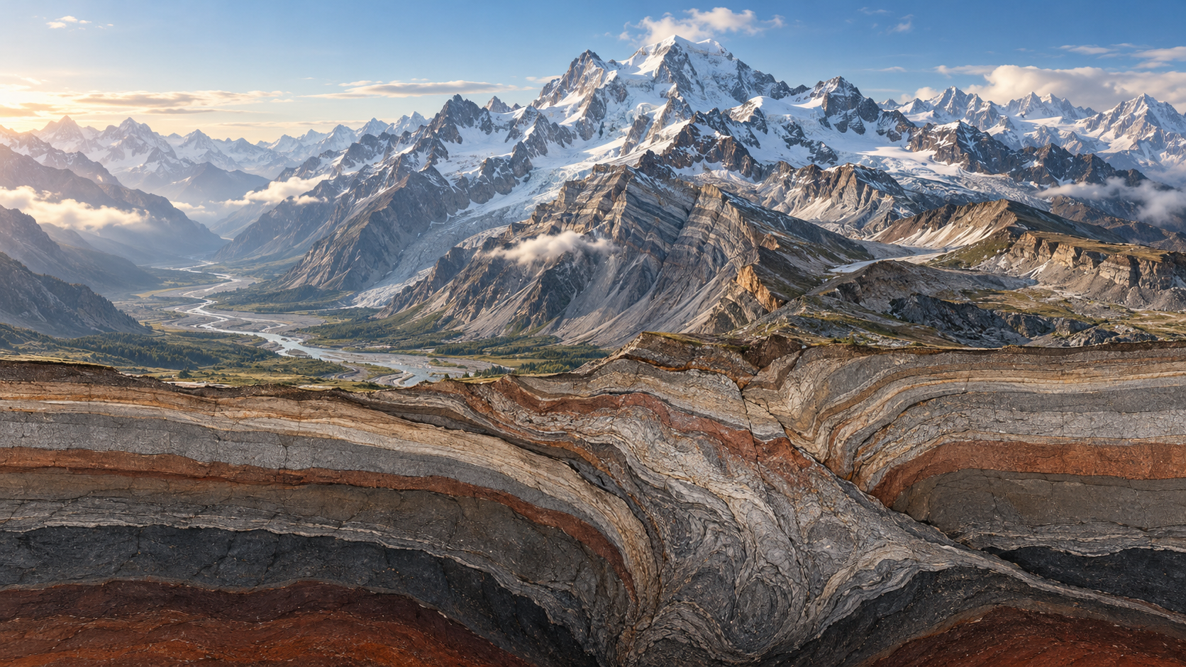
Mountain ranges are the long-term products of Earth’s internal dynamics. They form when the crust is shortened, thickened, folded, faulted, intruded by magma, or locally uplifted. Yet mountains are not created by uplift alone: they are simultaneously modified by rivers, glaciers, weathering, landslides, and erosion.
The shape, elevation, and lifespan of a mountain range result from the interaction between constructive processes within the lithosphere and destructive processes at Earth’s surface.
Lithosphere, Tectonic Plates, and Orogeny
Three terms must be clearly distinguished.
Lithosphere is Earth’s rigid outer mechanical layer. It includes the crust and the rigid uppermost mantle.
A tectonic plate is a large, relatively rigid fragment of the lithosphere that moves in relation to other plates.
Orogeny is a major episode of mountain building. It involves lithospheric deformation associated with plate convergence, subduction, continental collision, crustal shortening, thickening, folding, faulting, metamorphism, magmatism, and regional uplift. [1–3]
In other words, the lithosphere is a physical layer of Earth, tectonic plates are moving portions of that layer, and orogeny is the geological process through which mountain belts are formed.
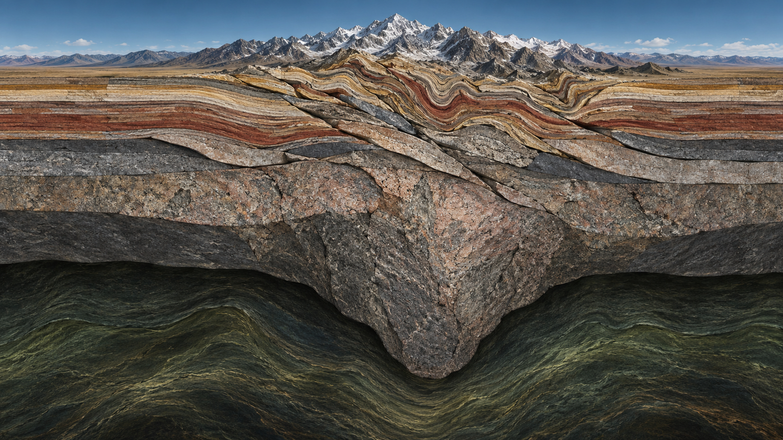
The Mechanical Basis of Mountain Building
Tectonic plates interact through three principal types of motion: convergence, divergence, and transform motion.
Convergence occurs when two tectonic plates move toward one another. It is the principal mechanism responsible for the formation of the world’s largest mountain belts. Convergence may involve oceanic lithosphere subducting beneath another plate or the collision of two continental plates.
Divergence occurs when the lithosphere is stretched and thinned. Divergent settings produce fault systems, sedimentary basins, rift valleys, and fault-block mountains. Volcanism is also common in these environments.
Transform motion occurs when two plates move laterally past one another. Transform boundaries do not usually form broad mountain belts, but local compression can occur where a fault bends or where plate motion is oblique. These compressional zones may create folds, faults, and localized mountain uplifts. [1], [2]
Crustal Shortening and Thrust Faulting
At convergent plate boundaries, the crust undergoes compression. This process is known as crustal shortening, because a region becomes shorter in the horizontal direction.
Rock layers may initially deform by folding. If compression continues, faults develop. A fault is a fracture, or a zone of fractures, across which rocks have moved relative to one another.
In compressional environments, reverse faults commonly form. In a reverse fault, one block of rock moves upward relative to another. When a reverse fault has a low angle of dip and displaces rocks over long distances, it is called a thrust fault.
A large body of rock transported tens of kilometres from its original position along thrust faults is known as a nappe. In simpler terms, it is a displaced sheet of rock that has been pushed over other rock units. Nappes are characteristic of the Alps, Himalayas, and many ancient collision belts. [2], [4]
Crustal Thickening and Mountain Roots
Mountain elevation is not determined only by what is visible at the surface. During compression, the crust can thicken both upward and downward. Beneath many high mountain ranges lies a thickened crustal “root.”
This is explained by isostasy, the density-dependent balance between the crust and the mantle. Continental crust is less dense than mantle rock, so thickened crust can remain elevated above the surrounding terrain while extending deeply into the mantle. [3], [5]
The great elevation of the Himalayas and the Tibetan Plateau is closely related to large-scale crustal thickening. However, each mountain belt has a distinct structure controlled by its rock composition, temperature, fault systems, tectonic history, and erosion rate.
Metamorphism, Magmatism, and Deep Crustal Deformation
During mountain building, rocks do not only fracture. At greater depths, where temperature and pressure are high, rocks may change their mineral composition and internal structure without completely melting. This process is called metamorphism.
Sedimentary or volcanic rocks may become gneiss, schist, or other metamorphic rocks under high-pressure and high-temperature conditions. These rocks are often exposed in the cores of mountain ranges after erosion removes the overlying material.
In some settings, part of the crust may melt and form magma. If magma cools below the surface, it forms intrusive igneous rocks such as granite. If it reaches the surface, it produces volcanic activity. These processes are particularly important in subduction zones and in some continental collision belts. [3], [4]
Erosion as an Active Component of Mountain Systems
Erosion is the breakdown and transport of rock by rivers, glaciers, wind, frost action, and landslides. It reduces mountain relief, but its role is not limited to destruction.
As erosion removes the upper layers of a mountain range, metamorphic and granitic rocks that once formed deep within the crust can become exposed at the surface. This is why mountain landscapes often reveal rocks that record conditions far below the present ground level.
The removal of mass can also alter crustal loading. In some cases, thickened crust rises gradually in response to erosion as it adjusts toward isostatic equilibrium. Mountain building and erosion are therefore closely coupled processes. [5], [6]
Fold-and-Thrust Mountain Belts
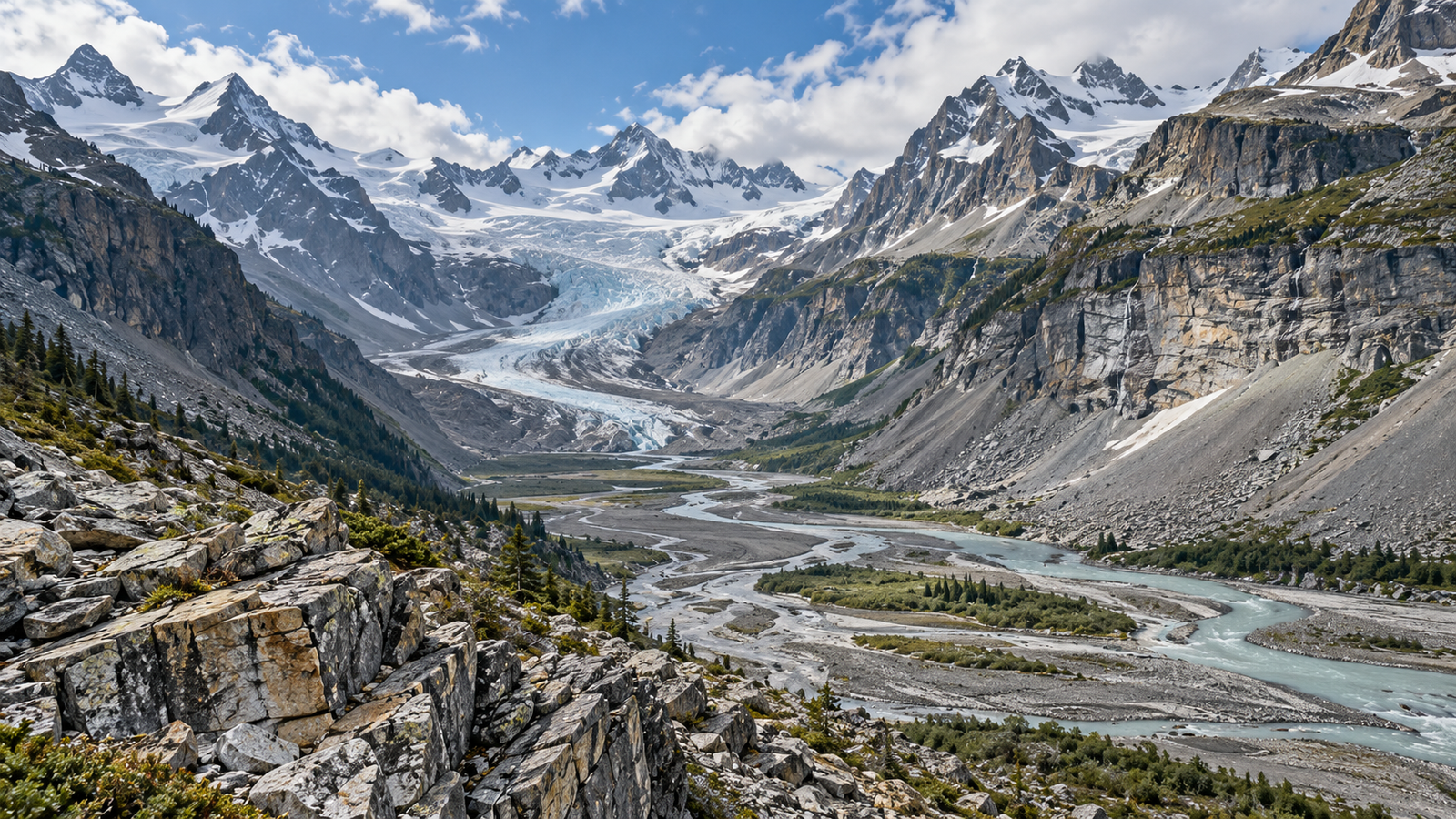
Fold-and-thrust mountain belts form in regions of strong compression. Rock layers are folded, reverse and thrust faults develop, and the crust becomes thicker.
The Himalayas and the Alps are classic examples. Their structures include multiple generations of folds, thrust faults, nappes, metamorphic zones, and major fault systems.
Fault-Block Mountains
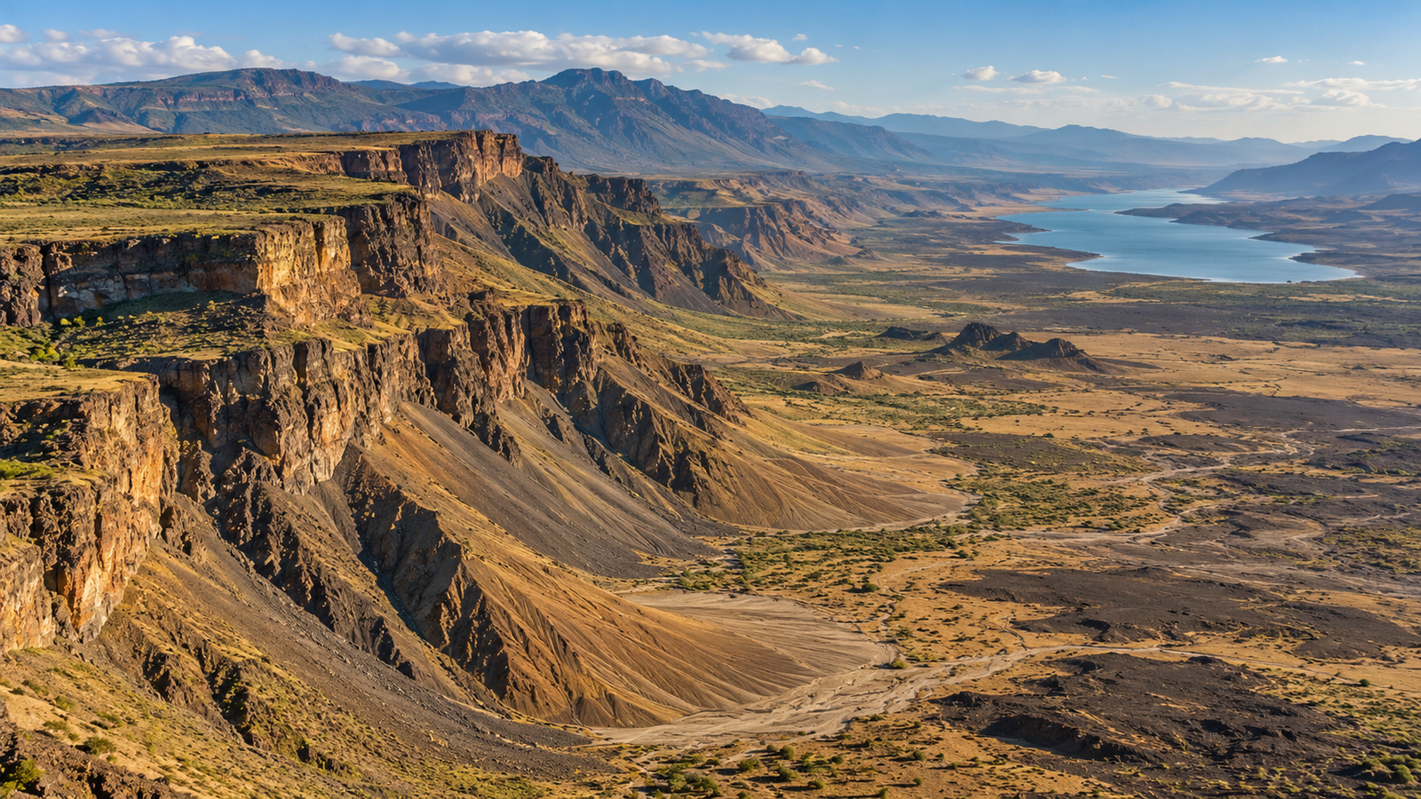
Fault-block mountains form when the crust is stretched and broken by normal faults. Some blocks rise, while adjacent blocks subside.
The uplifted blocks form mountain ranges, while the down-dropped blocks may form valleys or sedimentary basins. These structures are common in continental rifts, including the East African Rift System. [1], [2]
Volcanic Mountains
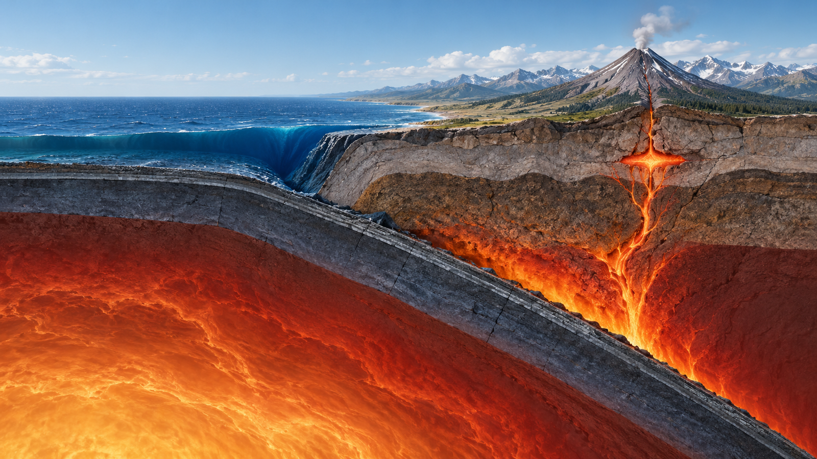
Volcanic mountains form through the accumulation of lava, ash, volcanic fragments, and other eruptive materials. They may develop as steep-sided stratovolcanoes or broad, gently sloping shield volcanoes.
At subduction zones, fluids released from the descending oceanic plate promote partial melting in the mantle above it. The resulting magma rises through the crust and can form volcanic arcs, such as the Andes, the Japanese volcanic belt, and the Cascade Range. [4], [17]
Domal Uplifts and Laccolithic Mountains
Some mountains form when magma intrudes between sedimentary rock layers and lifts the overlying strata into a dome-like shape. This mushroom-shaped intrusive body is called a laccolith.
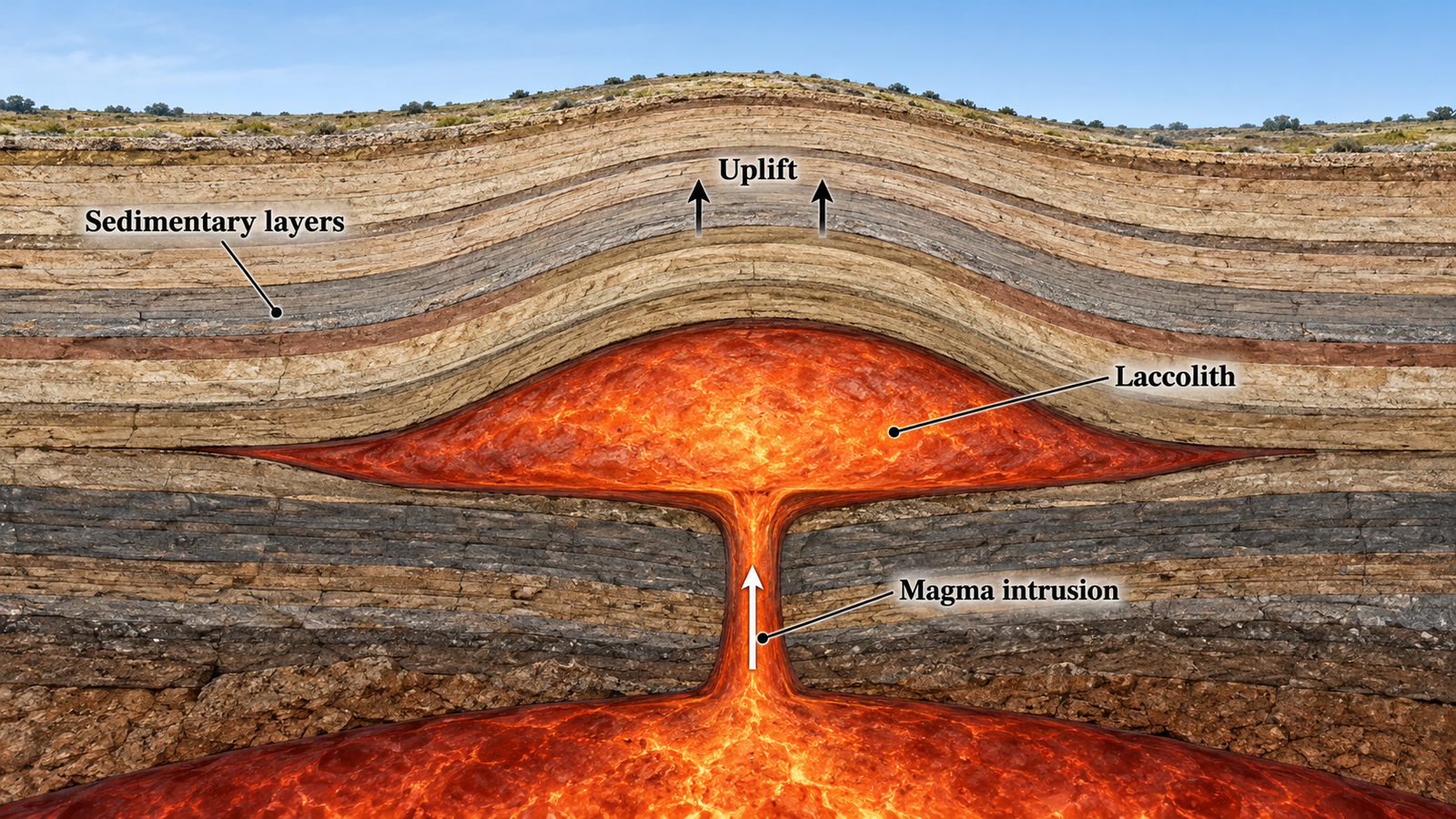
The magma may cool and crystallize at depth without erupting. Later erosion can remove the sedimentary cover and expose the resistant intrusive rocks beneath. This process may create isolated domal or massif-like uplands. [7]
Diapiric Uplifts
A diapir is a geological structure in which relatively buoyant and ductile material rises through denser surrounding rocks.
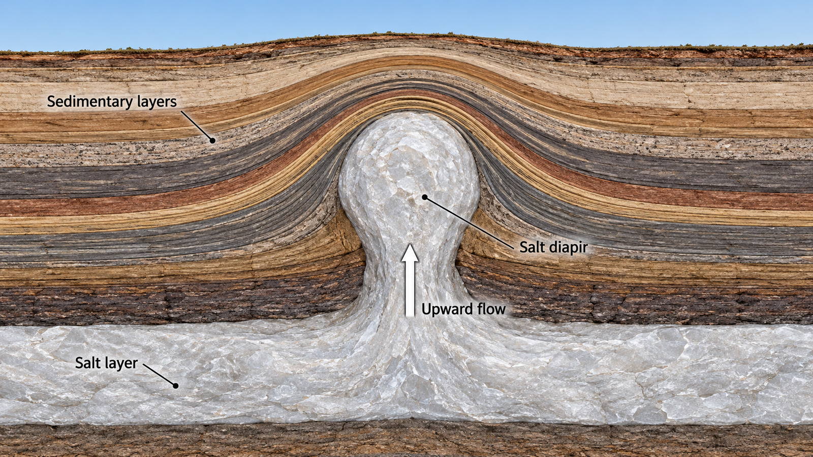
The most common example is a salt diapir. Deep salt layers can slowly flow upward under pressure because salt is commonly less dense and more deformable than the sedimentary rocks above it.
As the salt rises, it bends the overlying layers and creates a domal structure. If the salt pierces through the cover rocks, it forms a salt diapir. Diapiric uplifts are generally local structures rather than major mountain belts like the Himalayas or Andes. They are important in the geology of sedimentary basins, salt deposits, and hydrocarbon systems. [8], [9]
The Himalayas, Karakoram, and Tibetan Plateau
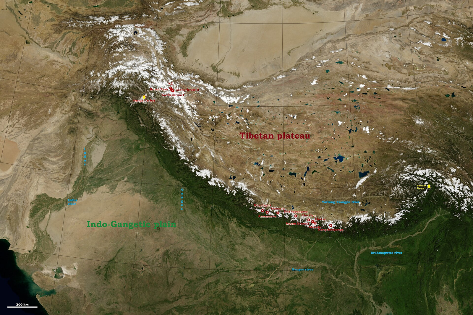
The Himalaya–Karakoram–Tibet system is one of the world’s most important active continental collision zones. It formed through the convergence of the Indian and Eurasian tectonic plates.
Before continental collision, oceanic lithosphere belonging to the Tethys Ocean was subducted. Once the continental margins met, large-scale crustal shortening, thickening, thrust faulting, metamorphism, and regional uplift followed.
The Himalayas and Tibetan Plateau cannot be explained by a single fault or one earthquake. They are the result of long-term continental collision, crustal deformation, magmatism, erosion, and isostatic adjustment. [10], [11]
The Alpine–Himalayan Orogenic Belt
The Alpine–Himalayan belt includes the Alps, Carpathians, Caucasus, Zagros Mountains, Iranian Plateau, Pamir, Himalayas, and several adjacent mountain systems. It is not a single mountain chain formed at one time.
Instead, it is a broad region composed of related but geologically distinct orogenic systems. Its evolution reflects the closure of Tethyan ocean basins, oceanic subduction, continental collision, and the accretion of continental blocks to Eurasia. [12], [13]
The Alps
The Alps formed through convergence between Europe and the Adriatic–African tectonic systems. During this process, parts of the Tethys Ocean closed, followed by continental collision, crustal shortening, and thickening.
The Alps contain major thrust faults, nappes, and metamorphic rocks. These structures demonstrate that large rock masses were transported not only vertically but also horizontally over considerable distances. [14]
The Andes
The Andes formed primarily through subduction of the Nazca Plate beneath the South American Plate. This process compresses the western margin of South America, thickens the crust, and creates conditions for volcanic arc formation.
The Andes are not structurally uniform along their entire length. Variations in subduction angle, crustal thickness, and fault systems influence the width, elevation, deformation style, and volcanic activity of different sections of the mountain belt. [15], [16]
The Rocky Mountains and the Appalachians
A major phase in the formation of the Rocky Mountains is associated with the Laramide Orogeny. During this event, deformation occurred far inland from the western plate boundary of North America.
One major explanation involves shallow-angle subduction of part of the Farallon Plate beneath North America. This may have transmitted compressional stresses far into the continental interior. However, the complete mechanism of the Laramide Orogeny remains an active subject of geological research. [17]
The Appalachians are an ancient mountain belt formed through the closure of former ocean basins, the accretion of island arcs, and continental collisions during the Paleozoic Era.
They are much lower today than the Himalayas because hundreds of millions of years of erosion have removed much of their original relief. Their folded, faulted, and metamorphic rocks preserve evidence of those ancient tectonic events. [18]
Famous Volcanoes and Their Tectonic Settings
Mount Fuji in Japan is a stratovolcano formed in a subduction-zone environment. [19]
Mount St. Helens is part of the Cascade volcanic arc. It is related to the subduction of the Juan de Fuca Plate beneath the North American Plate. [20]
Kīlauea, in Hawai‘i, is not located at a plate boundary. It formed above a deep mantle hot spot within the Pacific Plate. As the plate moves over the hot spot, a chain of volcanic islands and seamounts develops. [21]
Kilimanjaro is located in the East African Rift, where continental lithosphere is being extended and thinned. This setting facilitates magma ascent and the formation of volcanic structures. [22]
How Geologists Reconstruct Mountain-Building Histories
Geologists use several independent methods to reconstruct the formation of mountain systems:
- Geological mapping
- Structural analysis of folds and faults
- Radiometric dating of rocks and minerals
- Pressure-temperature analysis of metamorphic minerals
- Seismic imaging of crustal and mantle structure
- GPS measurements of present-day plate motion
- Study of sedimentary basins
- Satellite measurements of crustal deformation
The combination of these methods allows scientists to determine whether a mountain system formed through continental collision, oceanic subduction, continental rifting, magmatic intrusion, diapiric uplift, or long-term erosional modification.
Conclusion
Mountains are geodynamic systems, not simply areas of high relief. Their formation is linked to lithospheric deformation, plate tectonics, crustal shortening and thickening, faulting, magmatism, metamorphism, isostasy, and erosion.
The Himalayas represent continental collision; the Andes illustrate oceanic subduction; the Alps record the closure of Tethyan basins; the Appalachians preserve the remains of ancient orogenies; and the Hawaiian Islands demonstrate the effect of hotspot volcanism within a tectonic plate.
Scientific Sources and Books
[1] U.S. Geological Survey. What Is a Tectonic Plate?
[2] British Geological Survey. Geological Glossary: Faults, Thrusts, Nappes, Orogenesis, and Related Terms
[3] Turcotte, D. L., & Schubert, G. Geodynamics, 3rd Edition, Cambridge University Press, 2014. Book
[4] Stern, R. J. “Subduction Zones.” Reviews of Geophysics (2002). Scientific article
[5] Swanson, C. O. “Isostasy and Mountain Building.” The Journal of Geology (1928). Scientific article
[6] Li, S. et al. “How Erosion Shapes Dynamic Quaternary Mountain Environments: A Review.” Quaternary Science Advances (2023). Scientific article
[7] Colorado Geological Survey. Laccoliths and Plutonic Rocks
[8] Utah Geological Survey. Dome, Diapir, and Dome Mountain Structures
[9] Rowan, M. G., & Vendeville, B. C. “Passive Versus Active Salt Diapirism.” AAPG Bulletin (2021). Scientific article
[10] Yin, A., & Harrison, T. M. “Geologic Evolution of the Himalayan-Tibetan Orogen.” Annual Review of Earth and Planetary Sciences (2000). Scientific article
[11] Treloar, P. J., & Searle, M. P., eds. Himalayan Tectonics: A Modern Synthesis. Geological Society of London, 2019. Book
[12] Fan, J. et al. “Multiple Tethyan Ocean Basins and Orogenic Belts in Asia.” Gondwana Research (2021). Scientific article
[13] Straume, E. O. et al. “Collision, Mantle Convection and Tethyan Closure in the Eastern Mediterranean.” Nature Reviews Earth & Environment (2025). Scientific article
[14] Kissling, E., & Schlunegger, F. “Rollback Orogeny Model for the Evolution of the Swiss Alps.” Tectonics (2018). Scientific article
[15] Horton, B. K. “Sedimentary Record of Andean Mountain Building.” Earth-Science Reviews (2018). Scientific article
[16] Martinod, J. et al. “Widening of the Andes: An Interplay Between Subduction Dynamics and Crustal Wedge Tectonics.” Earth-Science Reviews (2020). Scientific article
[17] Weil, A. B., & Yonkee, A. “The Laramide Orogeny: Current Understanding of the Structural Style, Timing, and Spatial Distribution.” Geological Society of America Memoir (2023). Scientific article
[18] Hatcher, R. D., Thomas, W. A., & Viele, G. W., eds. The Appalachian-Ouachita Orogen in the United States. Geological Society of America. Book
[19] Smithsonian Institution, Global Volcanism Program. Fujisan
[20] U.S. Geological Survey. Mount St. Helens: Geological Setting
[21] U.S. Geological Survey. Geology of Hawai‘i Volcanoes National Park
[22] Smithsonian Institution, Global Volcanism Program. Kilimanjaro